fazer um pedido

280-Grande São Paulo com BaixadaAbrangendo todos os municípios de cada dessa região com rodovias e principais avenidas, na medida de 1,20x0,90 metros.
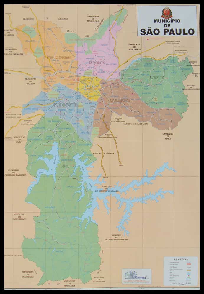
281 Mun. de São Paulo por RegiãoAbrangendo o município de São Paulo por região, cada região em cores diferentes, com rodovias e principais avenidas, na medida de 1,20x0,90 metros.
PODEMOS PERSONALIZAR SEU MAPA COLOCANDO O LOGO DA SUA EMPRESA OU ALGUMA TABELA.
Outras informações ligue ou clique aqui para mandar mensagem: Fone 011- 2578.6449.


291-Grande São Paulo com CEP, Abrangendo todos os municípios de cada região com rodovias e principais avenidas, na medida de 1,20x0,90 ou 1,50x1,25 metros.
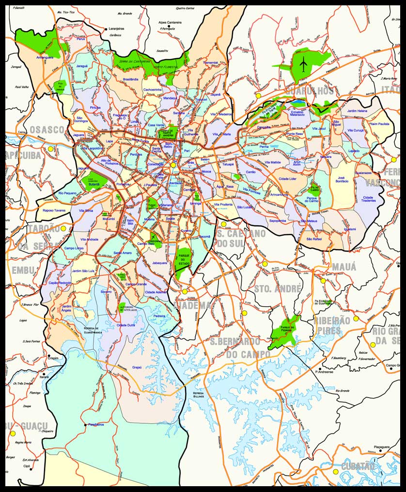
292-Mun.de São Paulo por Distrito por Distrito. Abrangendo todos os distrido de São Paulo por cores diferentes. com rodovias e principais avenidas, na medida de 1,20x0,90 ou 1,50x1,25 metros.

293- São Paulo com div. de CEP, abrangendo todos os distrido de São Paulo e o CEP por cores diferentes. com rodovias e principais avenidas, na medida de 1,20x0,90 ou 1,50x1,25 metros.

295-Rio de Janeiro e Baixada Flumiunense por CEP Abrangendo o Município do Rio de Janeiro com seus Bairros e a baixada Fluminense com cores diferentes por CEP com rodovias e principais avenidas, na medida de 1,30x0,80 ou 1,50x0,95 metros.

296-Região de Salvador Abrangendo todos os municípios da região de Salvador por cores diferentes. com rodovias e principais avenidas, na medida de 1,20x0,80 ou 1,50x1,00 metros.